
Home → Tours → A City on Glass Plates → Route
The route of “A City on Glass Plates”: ten camera points
Every stop of the route: where the photographer stood, the photograph itself and the story of what was here — the cathedrals of the kremlin, Blagoveshchenskaya Square, the funicular, the Zelensky descent, the crossing to the fair and Grebeshok. You can watch the whole tour or open it at any stop: each one has its own permanent address.
Start the tour from the beginning
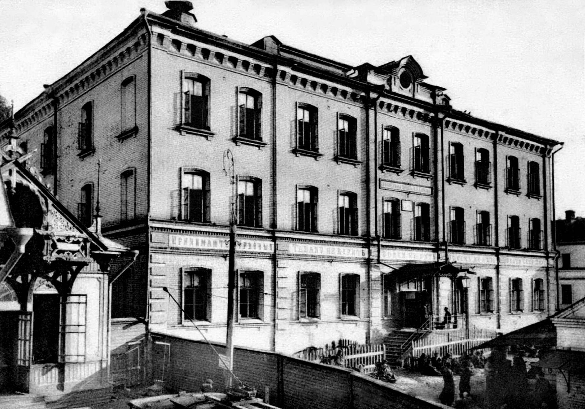
1886 — The studio of Maxim Dmitriev
the studio worked for more than forty years
Russian photojournalism began here. Maxim Dmitriev kept a studio on Osypnaya Street — today Piskunov Street — photographed the Volga from its source to its mouth and printed, in his own collotype workshop, an album about the famine of 1891 and 1892. The house that held his studio is now the Russian Museum of Photography.
In the tour the camera comes out at 56.3239, 44.0033 and turns 12° while the story is told.
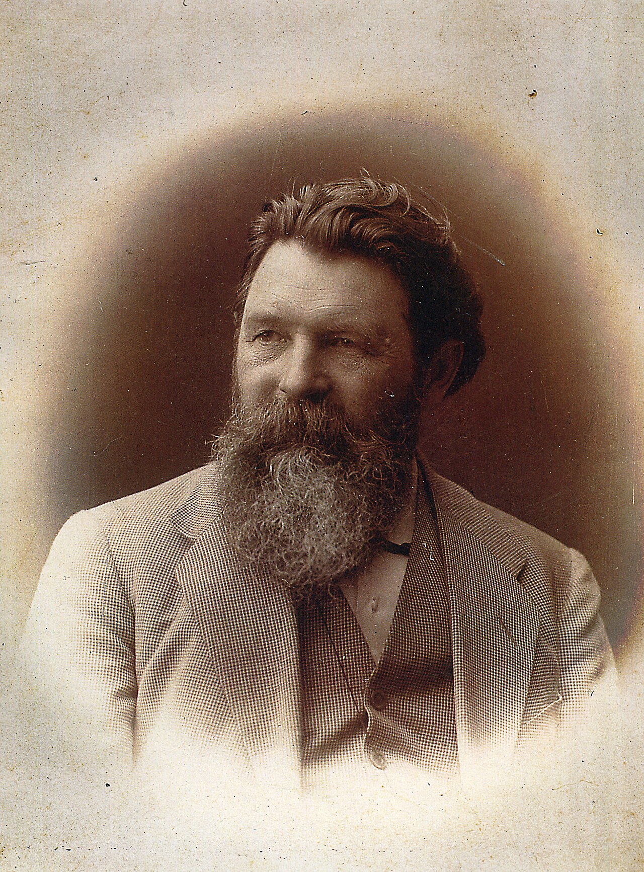
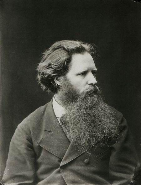

More in the encyclopedia: Maxim Dmitriev · Andrey Karelin
Start the tour at this stop Permanent address: www.nnov.ec/en/tour/glass-plates/stop/osypnaya
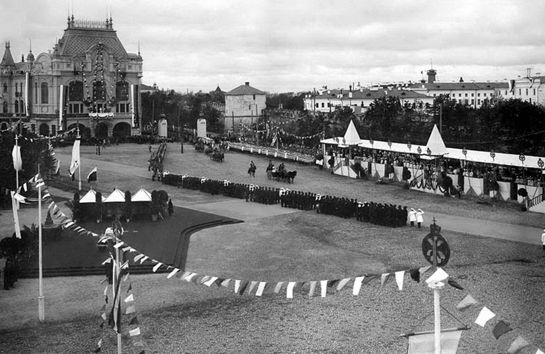
1930 — Blagoveshchenskaya Square
the cathedral came down on 18 August 1930
The main square of the upper town was called Blagoveshchenskaya, and in everyday speech the Upper Market. It took its name from the Cathedral of the Annunciation of the 1690s — the one standing beside the provincial school in the Karelin photograph. The cathedral was demolished on 18 August 1930, and the monument to Kuzma Minin stands on its place today.
In the tour the camera comes out at 56.3268, 44.0059 and turns 14° while the story is told.


More in the encyclopedia: Blagoveshchenskaya Square · Dmitrievskaya Tower
Start the tour at this stop Permanent address: www.nnov.ec/en/tour/glass-plates/stop/blagoveshenskaya
1929 — The cathedrals that are gone
both cathedrals of the kremlin fell in one year
Two cathedrals stood inside the kremlin, and both were photographed by our masters. The Transfiguration cathedral, built in the 1830s, was blown up in 1929 to clear the site for the House of Soviets; the tomb of Kuzma Minin lay in its undercroft, and in 1962 his remains were reburied in the Michael the Archangel cathedral. The Dormition military cathedral, founded in 1821, was pulled down in the same year.
In the tour the camera comes out at 56.3288, 44.0058 and turns 16° while the story is told.


More in the encyclopedia: Nizhny Novgorod Kremlin · Kuzma Minin
Start the tour at this stop Permanent address: www.nnov.ec/en/tour/glass-plates/stop/sobory
1904 — Clock hill and the Minin garden
the photograph was taken between 1904 and 1911
Dmitriev photographed the kremlin hill from above: Clock hill with the Minin garden, then the imperial garden with the church of Simeon the Stylite, and the Volga behind them. Karelin had photographed the same stretch of wall with the North and Clock towers back in the 1870s. The kremlin funicular ended at the Clock Tower — and it ends there again.
In the tour the camera comes out at 56.3288, 43.9989 and turns 18° while the story is told.


More in the encyclopedia: Clock Tower · Nizhny Novgorod Kremlin
Start the tour at this stop Permanent address: www.nnov.ec/en/tour/glass-plates/stop/chasovaya
1896 — The kremlin funicular
ran until 1926, came back in 2024
In 1896 the city opened two elevators at once — that was the word for the lifts that carried the public up the hill. The kremlin line ran from the foot of the church of John the Baptist to the Clock Tower and worked until 1926; the Pokhvalinsky line was taken apart in 1927. The kremlin funicular was rebuilt and opened again on 15 September 2024: 133 metres of track, part of it in a tunnel under the kremlin wall.
In the tour the camera comes out at 56.3299, 43.9951 and turns 14° while the story is told.


More in the encyclopedia: The Nizhny Novgorod Funicular · Pokhvalinsky Descent
Start the tour at this stop Permanent address: www.nnov.ec/en/tour/glass-plates/stop/elevator
19th c. — The view from the Ivanovskaya Tower
the photograph was taken in the late 19th century
From the Ivanovskaya Tower the kremlin drops to the lower town, and Dmitriev took in Rozhdestvenskaya Street and the Strelka from here — the whole merchant city in one frame. His second photograph, from the Nikolskaya Tower towards the Zelensky descent, shows how the road into the ravine looked.
In the tour the camera comes out at 56.3299, 43.9996 and turns 16° while the story is told.


More in the encyclopedia: Ivanovskaya Tower · Rozhdestvenskaya Street
Start the tour at this stop Permanent address: www.nnov.ec/en/tour/glass-plates/stop/ivanovskaya
1839 — The Zelensky descent and Balchug
opened to traffic on 22 September 1839
The descent was cut along the bottom of the old moat around the kremlin and became the main road between the upper and the lower town. Its name came from the Zeleiny yard, the powder store in the Pochaina ravine: in the 16th century gunpowder was called zelye. For its narrowness and its slope the townspeople nicknamed the road the Pipe.
In the tour the camera comes out at 56.3258, 44.0012 and turns 14° while the story is told.


More in the encyclopedia: Zelensky Descent · Balchug
Start the tour at this stop Permanent address: www.nnov.ec/en/tour/glass-plates/stop/zelensky
1929 — Cosmas and Damian, and the crossing
the church was blown up in the night of 12 July
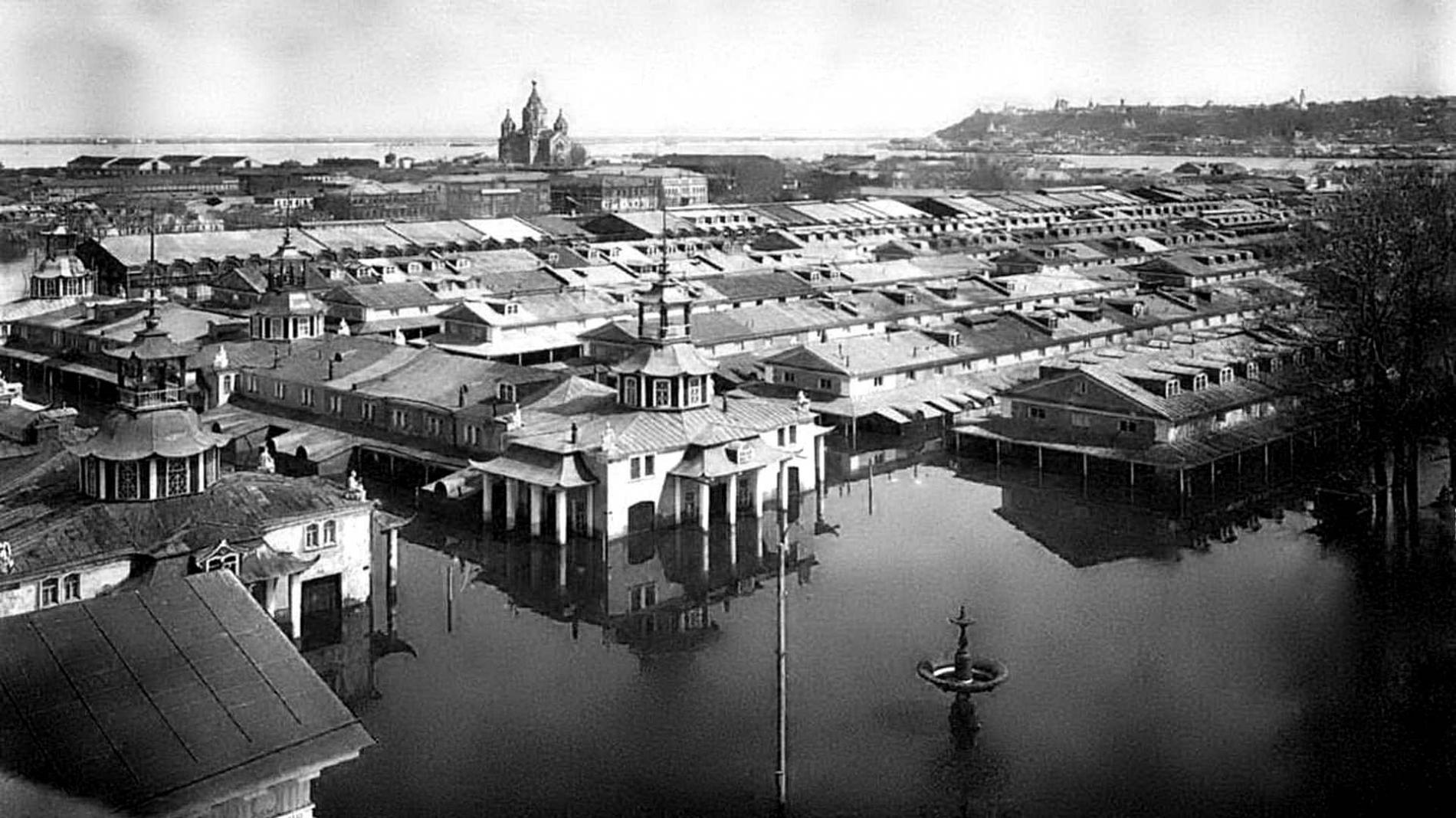
The church of Cosmas and Damian gave Rozhdestvenskaya Street its first name — Bolshaya Kozmodemyanskaya. The five-domed church designed by Lev Dahl was consecrated in 1890 and blown up in the night of 11 to 12 July 1929; the Nizhnovenergo building stands on its place. From this bank a pontoon bridge ran across the Oka to the fair — a floating road of twenty-six pontoons, assembled for the season and taken apart for the winter.
In the tour the camera comes out at 56.3285, 43.9883 and turns 14° while the story is told.


More in the encyclopedia: Church of Cosmas and Damian · Rozhdestvenskaya Street
Start the tour at this stop Permanent address: www.nnov.ec/en/tour/glass-plates/stop/sofronovskaya
1932 — The church of St George on the slope
the church of 1702 was blown up by June 1932
At the head of the Upper Volga embankment stood the church of St George the Victorious, completed by 1702 with money from the merchant Pushnikov. It was closed in March 1931 and blown up by June 1932, and the Rossiya hotel was built on the site. The hotel came down in the spring of 2020 — what the church left behind are the names of a descent and of a corner tower of the kremlin.
In the tour the camera comes out at 56.3301, 44.0164 and turns 14° while the story is told.


More in the encyclopedia: Georgievsky Descent · Historic Center
Start the tour at this stop Permanent address: www.nnov.ec/en/tour/glass-plates/stop/georgiy
1880s — Grebeshok
also known as Yarilina hill
The plateau above the steep right bank of the Oka: the bank, cut by ravines, looks like the comb of a cockerel, and that is where the name comes from. Until the middle of the 19th century the hill was called Yarilina and held the town festivities. From Grebeshok, Karelin photographed the cathedral of Alexander Nevsky and the Strelka — the very view people still climb here for.
In the tour the camera comes out at 56.3199, 43.9789 and turns 40° while the story is told.


More in the encyclopedia: Grebeshok · Cathedral of Alexander Nevsky
Start the tour at this stop Permanent address: www.nnov.ec/en/tour/glass-plates/stop/grebeshok
All 41 photographs by Karelin and Dmitriev — the whole set of photographs in an encyclopedia article.
The route is put together from articles of the Encyclopedia of Nizhny Novgorod. Other routes are on the tours page.