Home → Tours → Thirteen Towers of the Kremlin → Route
The route of “Thirteen Towers of the Kremlin”: the circuit of the walls
Every stop of the circuit of the kremlin walls, from the main gate and back to it: the Dmitrievskaya, Kladovaya, Nikolskaya, Koromyslova, Taynitskaya, Northern, Clock, Ivanovskaya, White, Zachatyevskaya, Borisoglebskaya, St George and Powder towers. You can watch the whole tour or open it at any stop: each one has its own permanent address.
Start the tour from the beginning
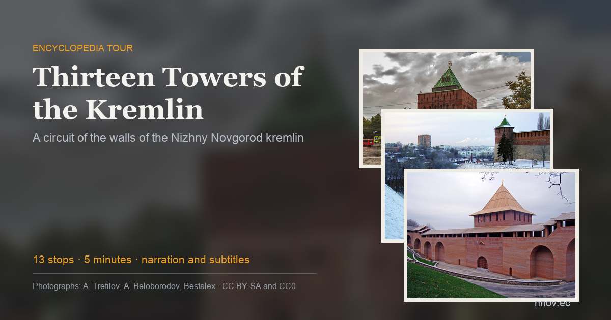
1895 — The Dmitrievskaya Tower
the kremlin was begun in 1500
The main gate of the fortress and the unofficial emblem of the city. The stone kremlin was begun in 1500, and the tower took its present Russian-revival look in 1895, for the All-Russian Exhibition: the architect Nikolai Sultanov crowned it with an iron tent roof carrying a glass globe. The tent roof still stands, the globe is gone, and since 1965 a gilded weathervane with the city arms — a walking deer — has turned on the spire.
In the tour the camera comes out at 56.3270, 44.0057 and turns 20° while the story is told.
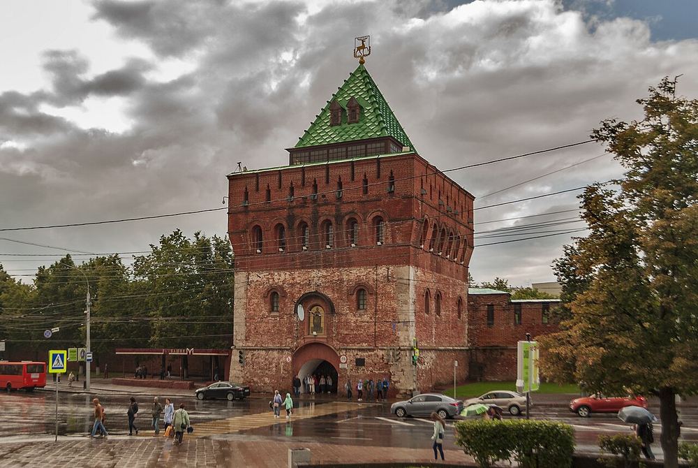
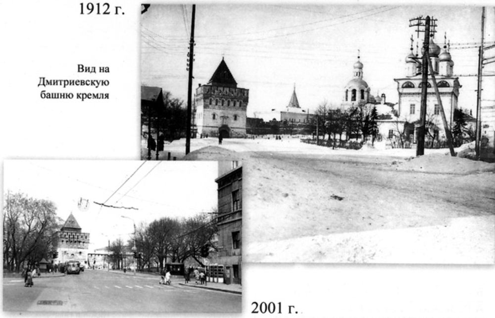
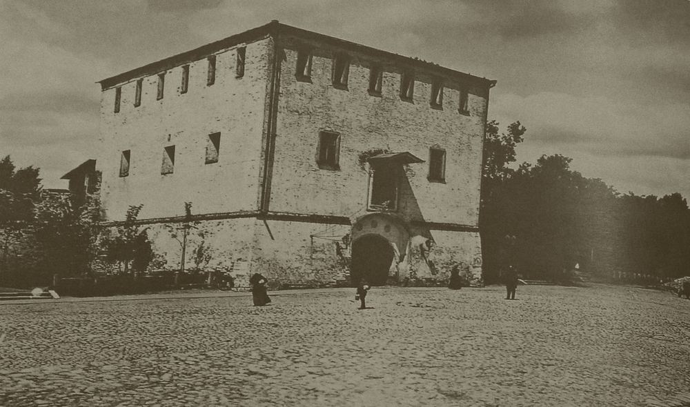
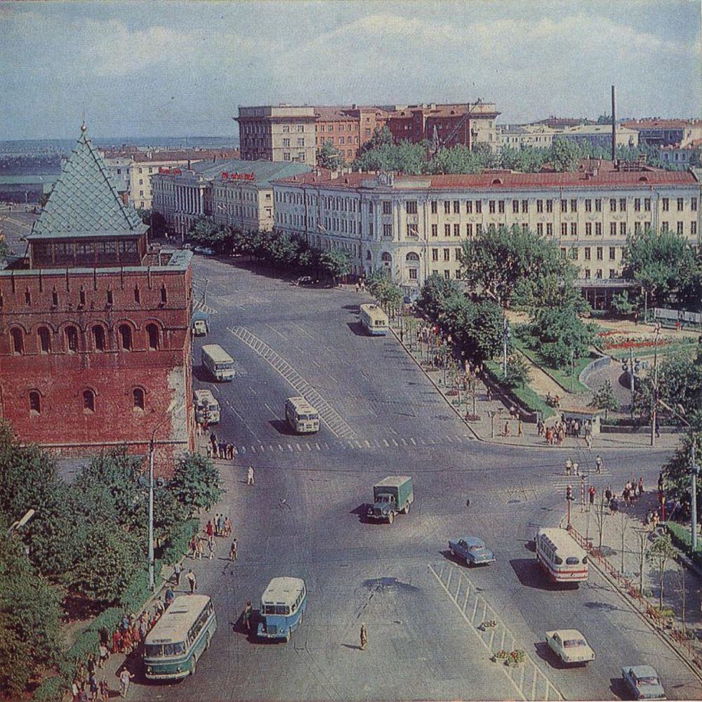
More in the encyclopedia: Dmitrievskaya Tower · Nizhny Novgorod Kremlin
Start the tour at this stop Permanent address: www.nnov.ec/en/tour/thirteen-towers/stop/dmitrievskaya
1500 — The Kladovaya Tower
founded on 1 September 1500
A round tower at the head of the Zelensky descent. It has an exact founding date — 1 September 1500 — recorded by the Solikamsk chronicler, together with its first name: Tverskaya. One version derives it from the Tver masters who built the fortress, another from the old word for a stronghold. In the 17th and 18th centuries the tower was called Alexeyevskaya, after a church that stood nearby.
In the tour the camera comes out at 56.3264, 44.0035 and turns 22° while the story is told.
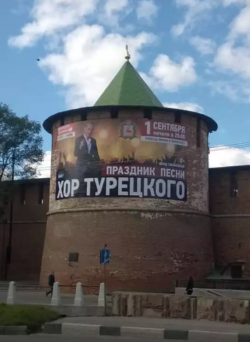
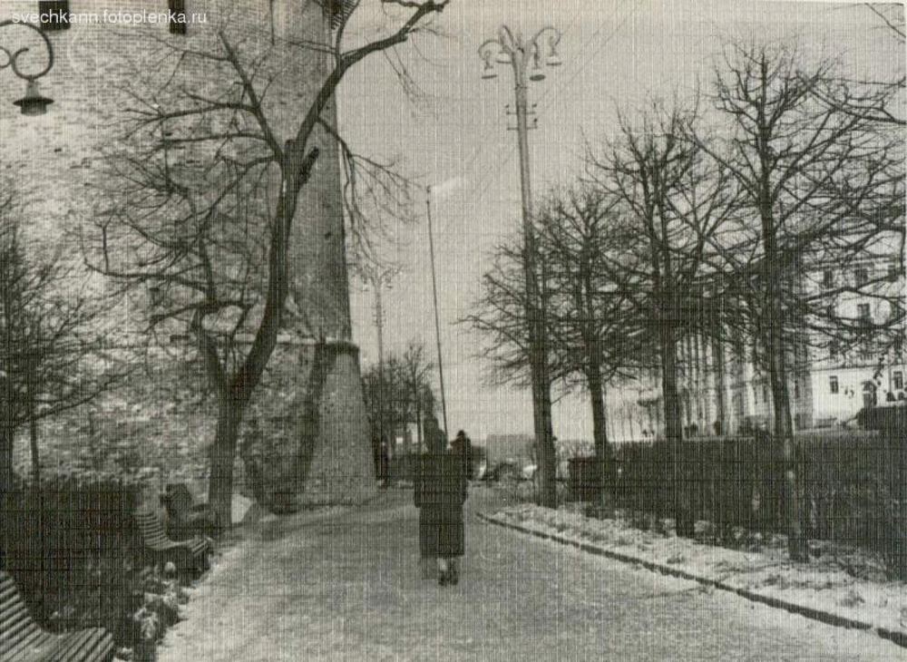
More in the encyclopedia: Kladovaya Tower · Zelensky Descent
Start the tour at this stop Permanent address: www.nnov.ec/en/tour/thirteen-towers/stop/kladovaya
16th c. — The Nikolskaya Tower
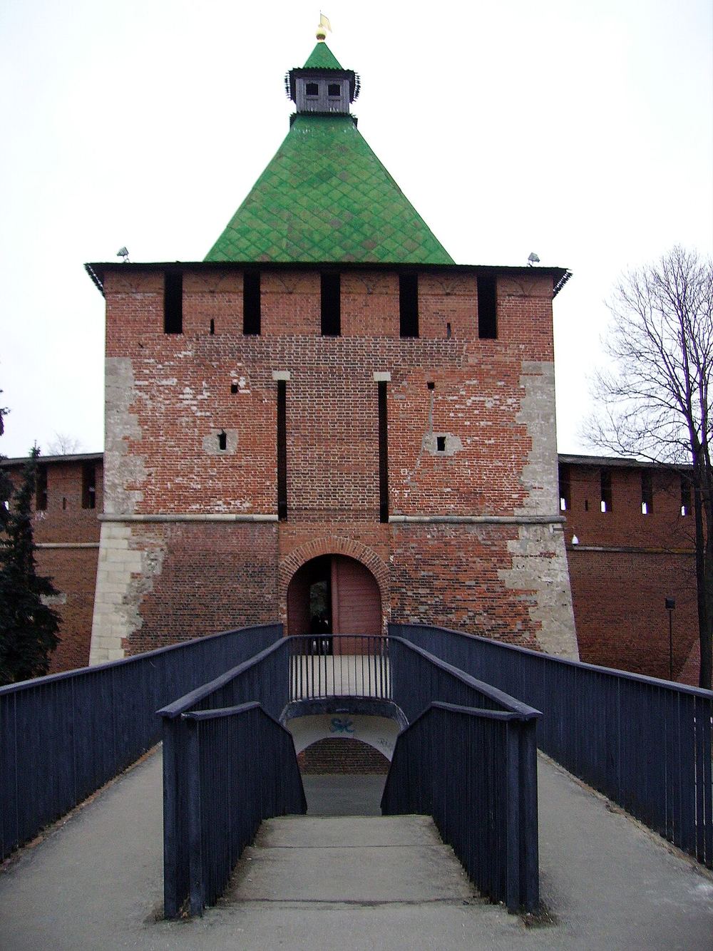
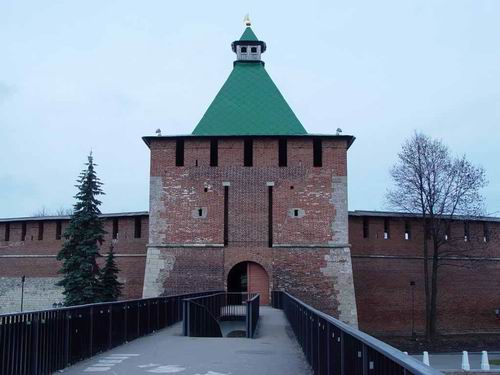
a footbridge leads to the tower
A gate tower on a rectangular base, named after the church of St Nicholas that stood opposite, across the Zelensky descent. Neither the church nor its graveyard survives, and a footbridge built in the 1980s now crosses the descent to the tower: that is the way into the kremlin from the far side of the ravine.
In the tour the camera comes out at 56.3257, 44.0014 and turns 22° while the story is told.
More in the encyclopedia: Nikolskaya Tower · Zelensky Descent
Start the tour at this stop Permanent address: www.nnov.ec/en/tour/thirteen-towers/stop/nikolskaya
16th c. — The Koromyslova Tower
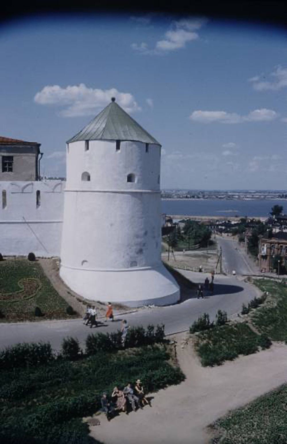
the best preserved of the round towers
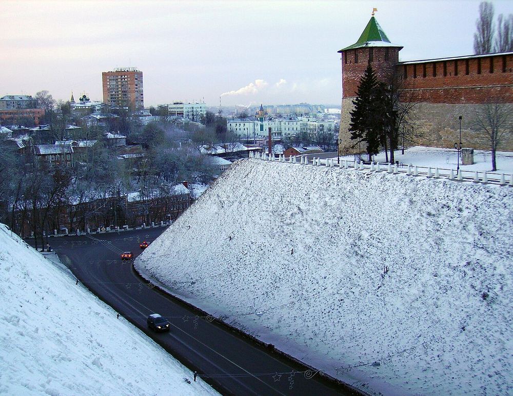
This tower has kept its original form better than any other round tower, and is built entirely of white stone, inner chambers included. It juts slightly beyond the line of the walls, which widened the field of fire, and behind it drops the steep slope of the Pochaina ravine. It carries the best known legend of the kremlin: a townswoman who fought off the enemy with a water yoke.
In the tour the camera comes out at 56.3258, 43.9990 and turns 26° while the story is told.
More in the encyclopedia: Koromyslova Tower · Nizhny Novgorod Kremlin
Start the tour at this stop Permanent address: www.nnov.ec/en/tour/thirteen-towers/stop/koromyslova
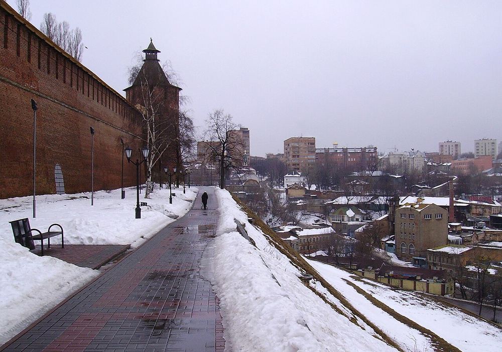
16th c. — The Taynitskaya Tower
a secret passage to the Pochaina
The tower is named after the underground passage that ran beneath the wall down to the river Pochaina: under a long siege the defenders went that way for water. A watch turret stands on its tent roof — only the Clock and Nikolskaya towers have the same. At different times it was also called Mironositskaya and Pochainskaya.
In the tour the camera comes out at 56.3276, 43.9973 and turns 24° while the story is told.
More in the encyclopedia: Taynitskaya Tower · Nizhny Novgorod Kremlin
Start the tour at this stop Permanent address: www.nnov.ec/en/tour/thirteen-towers/stop/taynitskaya
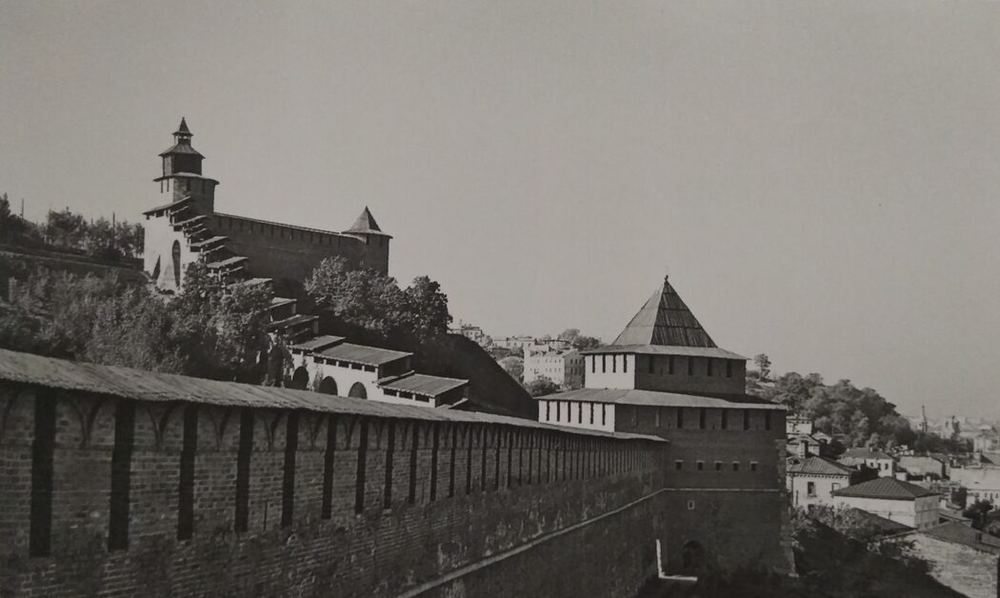
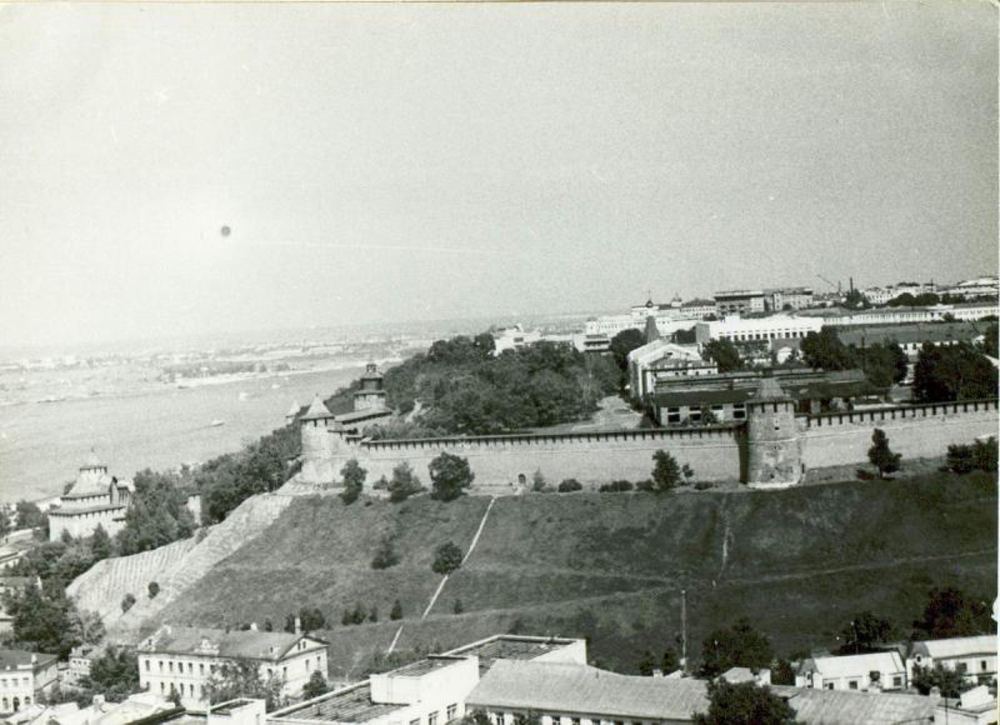
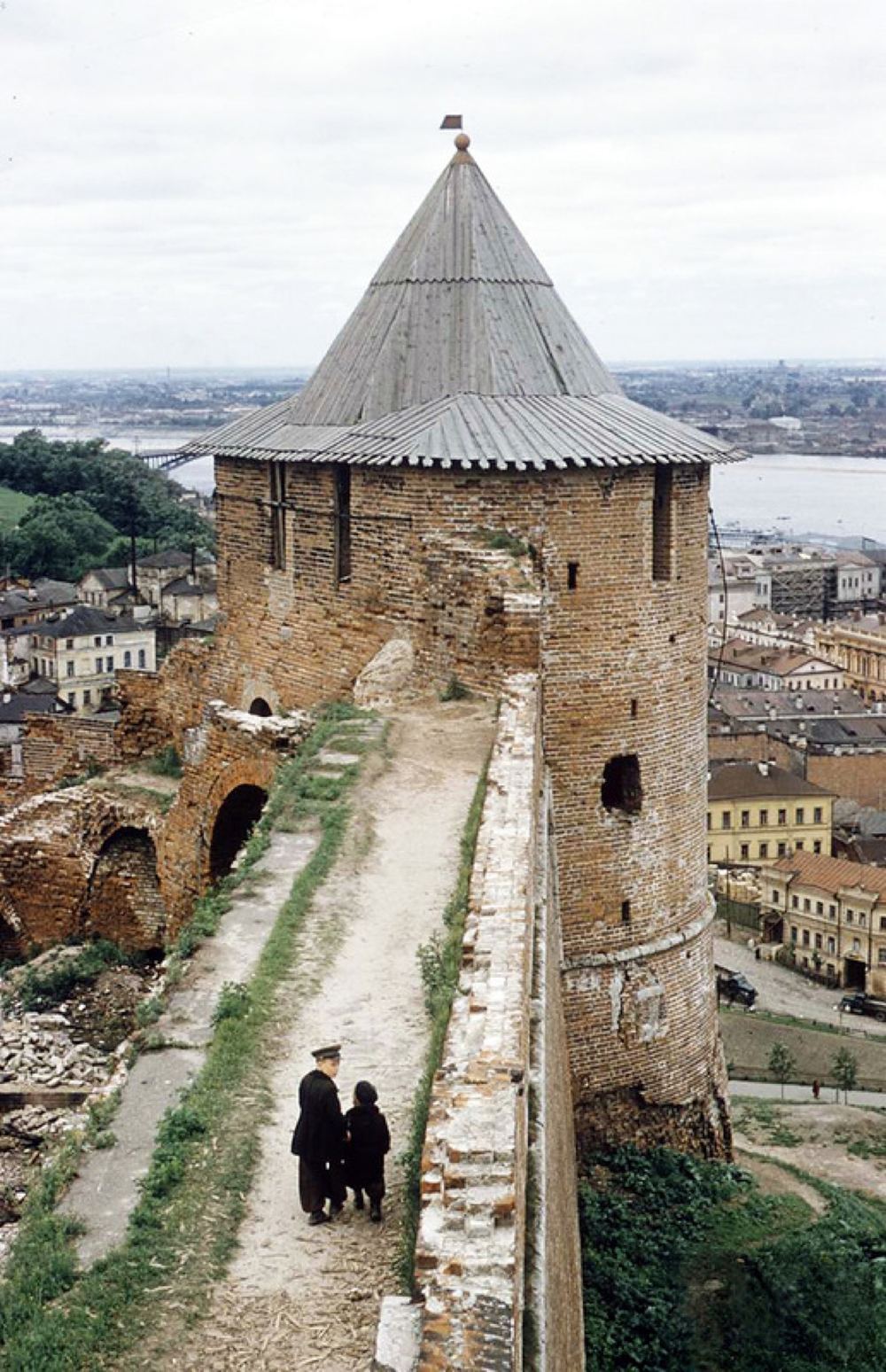
16th c. — The Northern Tower
called Naugolnaya in 17th-century records
Despite the name, this is not the northernmost tower of the kremlin: the explanation is that the wall runs due north from the Taynitskaya Tower to this one. Records of the 17th century call it Naugolnaya, the corner tower — and it does stand where the wall turns sharply from the Pochaina ravine to the slope of Clock hill.
In the tour the camera comes out at 56.3288, 43.9980 and turns 22° while the story is told.
More in the encyclopedia: Northern Tower · Nizhny Novgorod Kremlin
Start the tour at this stop Permanent address: www.nnov.ec/en/tour/thirteen-towers/stop/severnaya
2024 — The Clock Tower
a 16th-century clock, its dial recreated in 2024
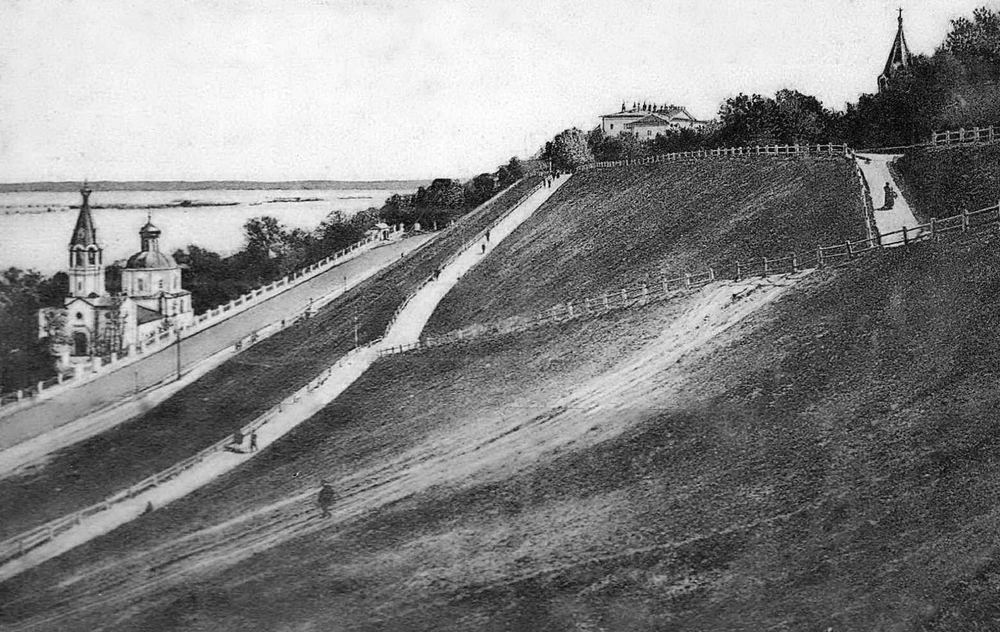
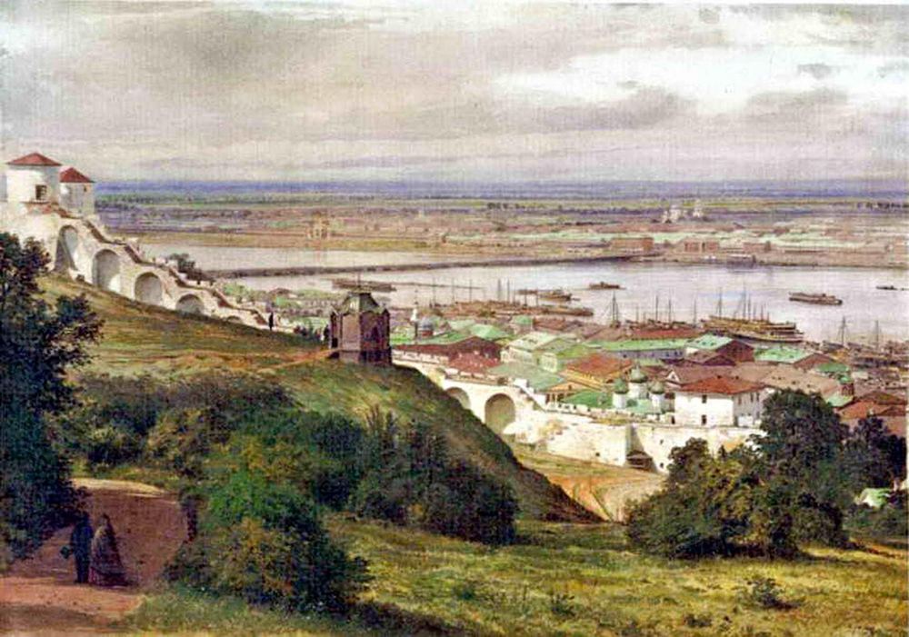
The tower stands on the highest point of the kremlin hill and served as the main watch post of the fortress. In the 16th century the main town clock and alarm bells were installed here; the dial had seventeen divisions, the number of hours in the longest Moscow summer day under the old Russian reckoning. In the winter of 2023 and 2024 that seventeen-hour dial and the striking of the bells were recreated.
In the tour the camera comes out at 56.3288, 43.9989 and turns 24° while the story is told.
More in the encyclopedia: Clock Tower · The Nizhny Novgorod Funicular
Start the tour at this stop Permanent address: www.nnov.ec/en/tour/thirteen-towers/stop/chasovaya
1500 — The Ivanovskaya Tower
built from 1500 to about 1516
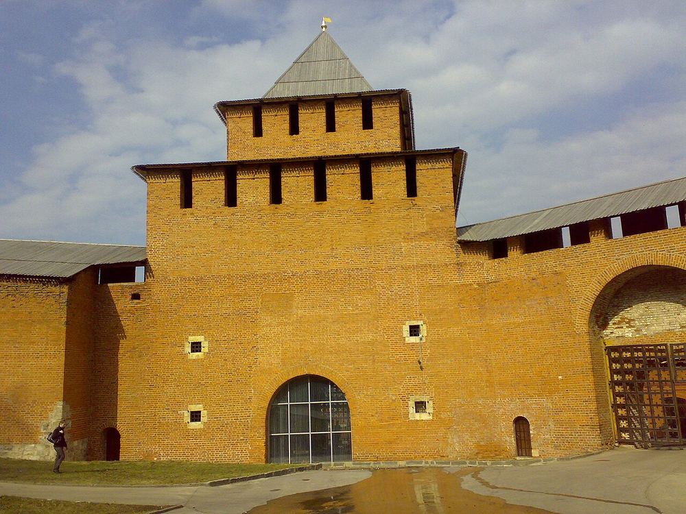
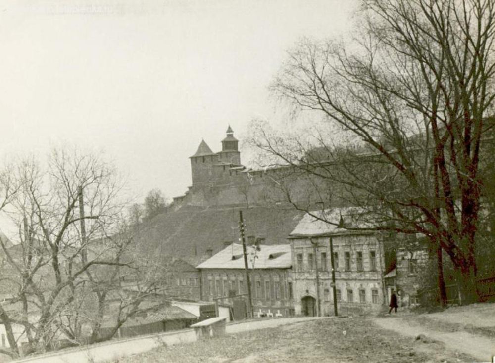
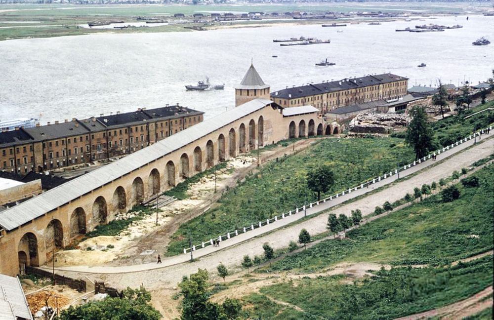
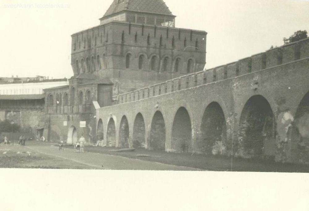
The largest gate tower of the kremlin, four tiers high, in the lower part of the fortress. It is named after the church of John the Baptist that stood on the approach to it: tradition says Kuzma Minin spoke to the people of Nizhny from its porch. In 1612 the militia marched out through these gates towards Moscow.
In the tour the camera comes out at 56.3299, 43.9996 and turns 24° while the story is told.
More in the encyclopedia: Ivanovskaya Tower · Kuzma Minin
Start the tour at this stop Permanent address: www.nnov.ec/en/tour/thirteen-towers/stop/ivanovskaya
16th c. — The White Tower
white stone below, brick above
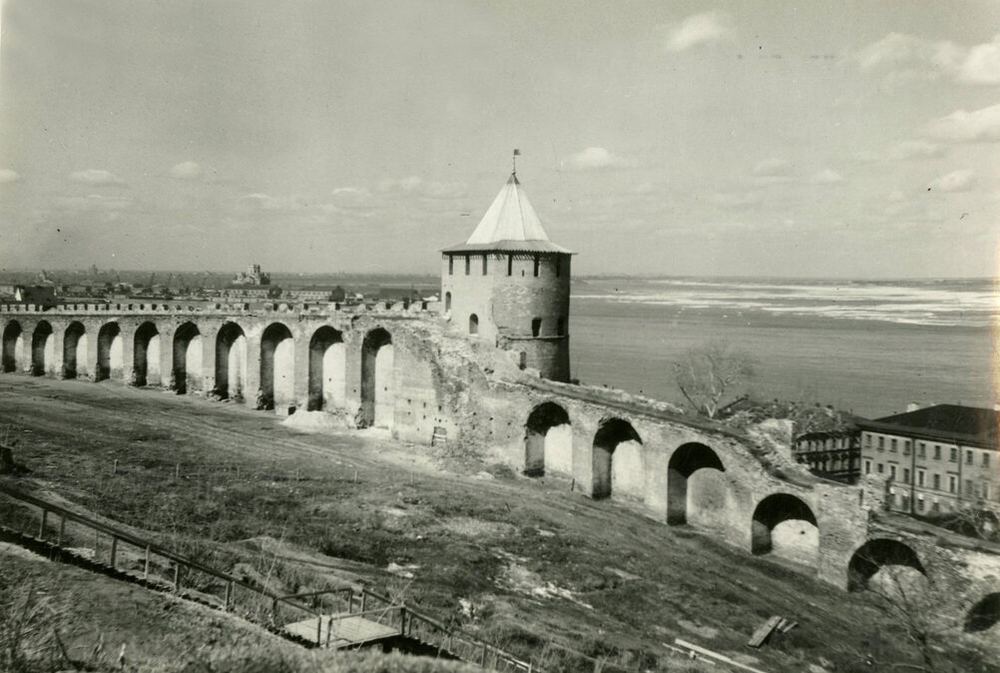
A round tower in the north-eastern part of the kremlin, named after the white stone facing of the lower part of its face; later it was called Simeonovskaya, after a monastery that stood nearby. The walls are built the same way: white limestone below, red brick above.
In the tour the camera comes out at 56.3305, 44.0018 and turns 22° while the story is told.
More in the encyclopedia: White Tower · Nizhny Novgorod Kremlin
Start the tour at this stop Permanent address: www.nnov.ec/en/tour/thirteen-towers/stop/belaya
2012 — The Zachatyevskaya Tower
collapsed about 1750, rebuilt in 2012
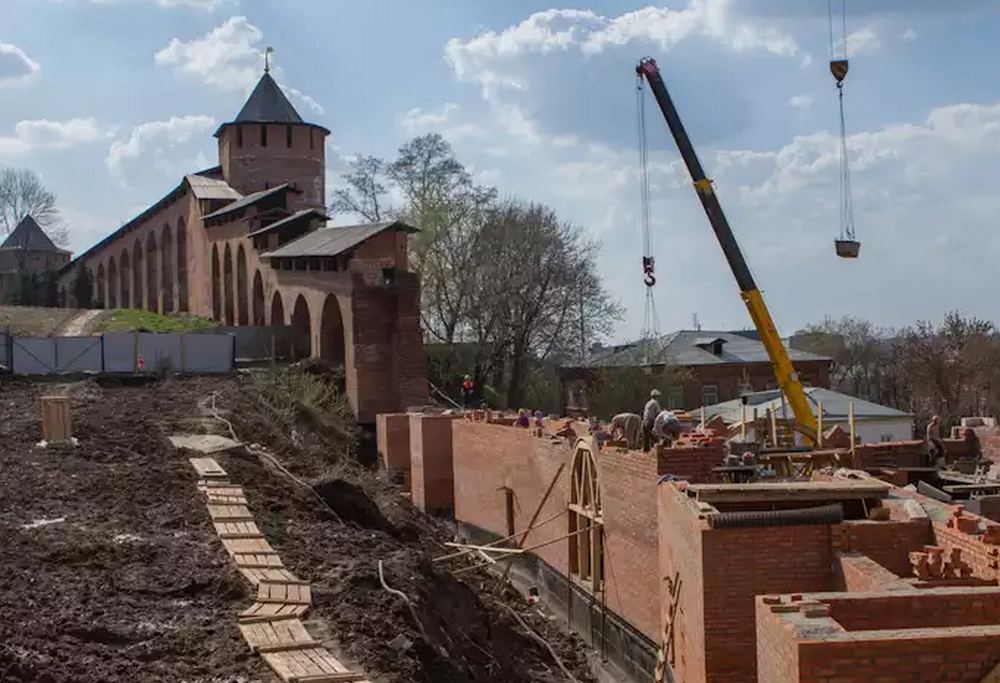
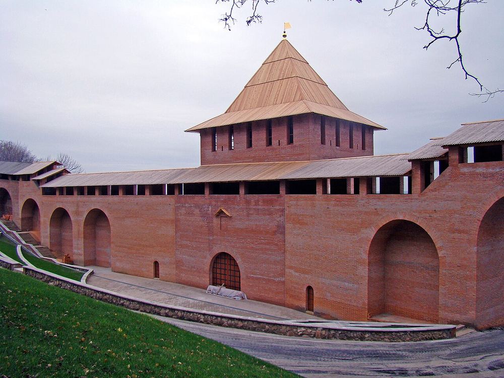
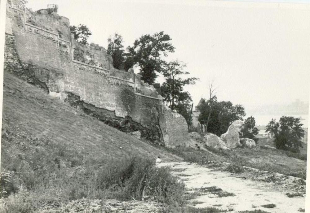
The only tower that was not raised again during the restoration of the mid-20th century. Around 1750 a landslide pushed it towards the Volga and it collapsed; what was left was taken apart for bricks in 1785 to 1787. It was rebuilt to the design of Svyatoslav Agafonov and opened in 2012 — and the ring of walls closed for the first time in two and a half centuries.
In the tour the camera comes out at 56.3308, 44.0034 and turns 26° while the story is told.
More in the encyclopedia: Zachatyevskaya Tower · Nizhny Novgorod Kremlin
Start the tour at this stop Permanent address: www.nnov.ec/en/tour/thirteen-towers/stop/zachatyevskaya
1972 — The Borisoglebskaya Tower
dismantled in 1785, rebuilt in 1972
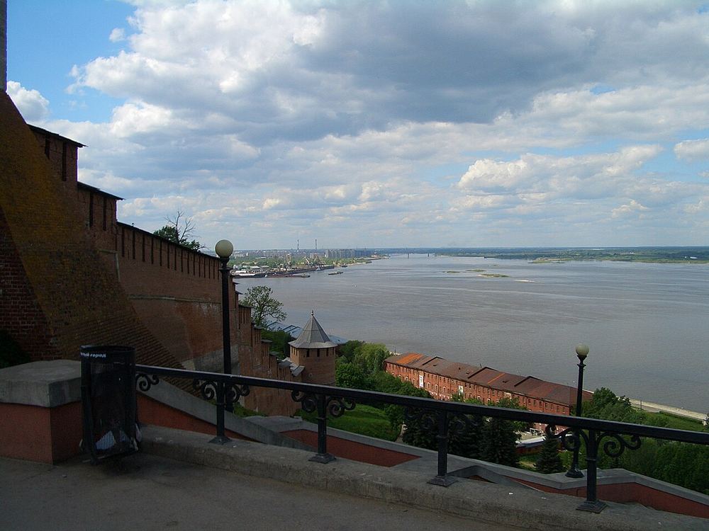
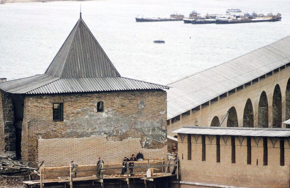
The tower is named after the church of Saints Boris and Gleb that stood nearby on the Volga bank. Groundwater undermined this one too: in 1785, by order of Catherine the Great, it was taken down and replaced by a passage with two guardrooms. Its foundation was excavated in 1966, and in 1972 the tower was rebuilt on its old place — again to a design by Agafonov.
In the tour the camera comes out at 56.3307, 44.0063 and turns 24° while the story is told.
More in the encyclopedia: Borisoglebskaya Tower · Nizhny Novgorod Kremlin
Start the tour at this stop Permanent address: www.nnov.ec/en/tour/thirteen-towers/stop/borisoglebskaya
16th c. — St George’s Tower
at the head of the Chkalov staircase
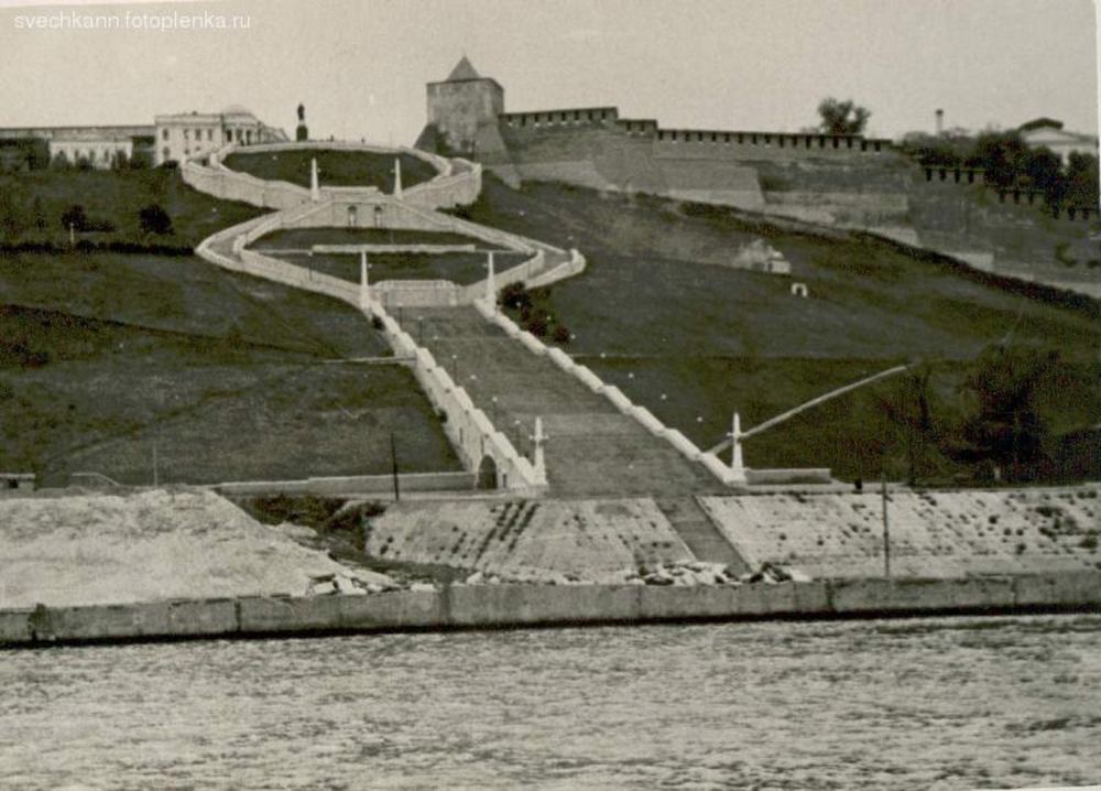
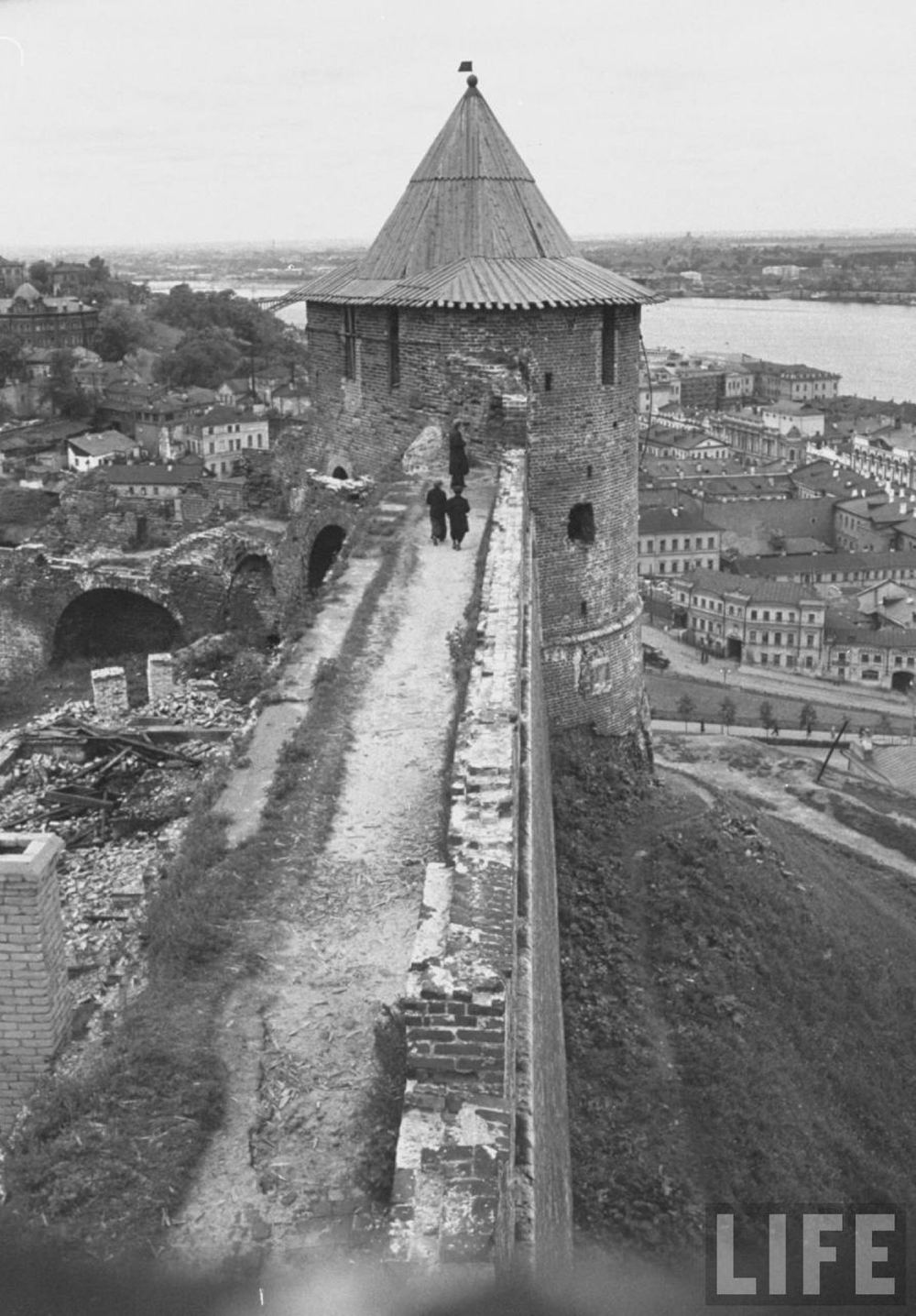
A round battle tower on the very edge of the slope, named after the church of St George: it was closed in 1931 and blown up by June 1932. Today the Chkalov staircase runs down from here to the Volga. Round towers had no gates: square gate towers and round battle towers alternated strictly around the perimeter of the kremlin.
In the tour the camera comes out at 56.3301, 44.0089 and turns 22° while the story is told.
More in the encyclopedia: St George’s Tower · The Chkalov Staircase
Start the tour at this stop Permanent address: www.nnov.ec/en/tour/thirteen-towers/stop/georgievskaya
16th c. — The Powder Tower
18 metres high
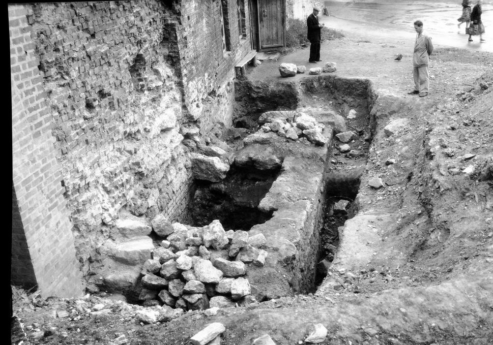
The last tower of the circuit held the gunpowder and ammunition, which is where the name comes from; people also called it Spasskaya. In peacetime grain and other stores were kept here. Beyond it the wall runs back to the Dmitrievskaya Tower, where we began: thirteen towers, about two kilometres of wall — the ring is closed.
In the tour the camera comes out at 56.3285, 44.0072 and turns 40° while the story is told.
More in the encyclopedia: Powder Tower · Nizhny Novgorod Kremlin
Start the tour at this stop Permanent address: www.nnov.ec/en/tour/thirteen-towers/stop/porokhovaya
The route is put together from articles of the Encyclopedia of Nizhny Novgorod. Other routes are on the tours page.